If you’re planning a renovation or thinking about selling a property in San Francisco, especially in areas like the Sunset District or Mission Bay, there’s one important document you don’t want to overlook: the FEMA elevation certificate. It helps show whether your building is at risk for flooding—and it’s often required for permits, insurance, or construction near the Bay.
It also pairs well with an ALTA Land Title Survey, which maps out legal property lines and easements. Together, these tools help you avoid surprises, stay compliant with local rules, and make smarter decisions before you build, sell, or insure.
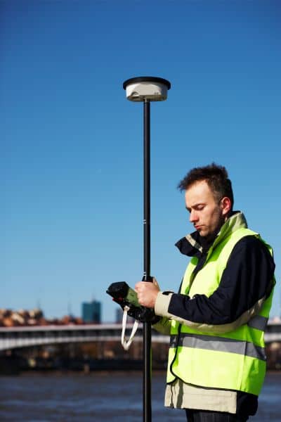
A FEMA elevation certificate is a formal document prepared by a licensed land surveyor, engineer, or architect. It shows key elevation data for a building in a flood zone. This includes:
The certificate is used by insurance agents, city officials, and FEMA to determine flood risk and insurance rates.
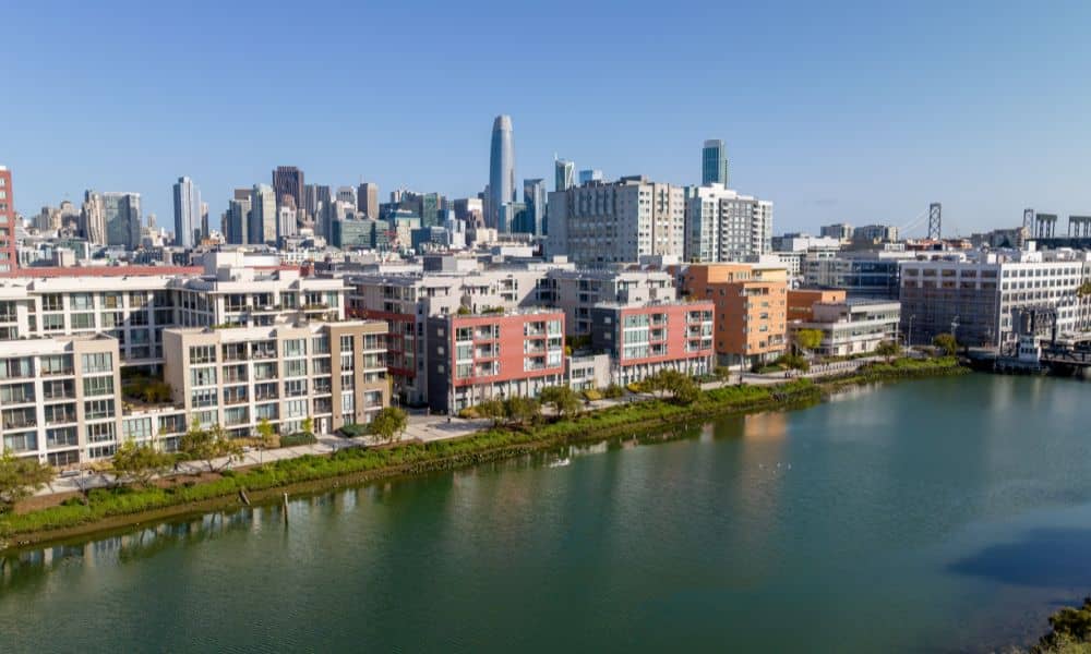
While San Francisco is known for its steep hills, not all areas sit at a safe elevation. Neighborhoods like Bayview-Hunters Point, Mission Bay, The Embarcadero, Portola District, and the Islais Creek area are flat, low-lying, or built on reclaimed land—making them more prone to flooding during storm surges, heavy rainfall, or king tides.
As sea levels rise and weather events become more intense, more properties in the city are being mapped into FEMA Special Flood Hazard Areas (SFHAs). If your home or building falls within one of these zones, you may be required to provide an elevation certificate when:
In these vulnerable neighborhoods, having up-to-date elevation data isn’t just about compliance—it can protect your investment and ensure your project moves forward without costly surprises.
When preparing a FEMA elevation certificate, the surveyor will:
You’ll receive a digital or printed copy that can be shared with your insurance agent, architect, or permitting office.
Your insurance company will use the elevation certificate to calculate your premium. If your property’s lowest floor is above the base flood elevation, you may qualify for a lower rate.
If your home is in a mapped flood zone and you’re renovating more than 50% of the structure’s market value (a “substantial improvement”), San Francisco building code may require floodproofing or elevation. An elevation certificate is often the first step.
New construction near the Bay must follow strict floodplain regulations. Before issuing permits, the city may require an elevation certificate to verify your proposed building’s compliance.
Buyers or lenders may ask for this document, especially if the property has been mapped into a flood zone recently. It helps clarify future insurance costs and property risks.
An elevation certificate includes:
This technical report is not something you can fill out yourself—it must be completed by a professional.
The survey usually takes a few hours onsite. The full certificate may take 1–3 business days to prepare, depending on weather, access, and availability of city and FEMA mapping data.
Some delays may occur in areas with limited elevation benchmarks, like near McLaren Park or the Outer Sunset. It’s smart to book a surveyor early if you’re working with tight permitting or insurance deadlines.
Example: A homeowner in the Portola District needed a permit to renovate their raised foundation. Without an updated elevation certificate, the city delayed their approval by two weeks. Planning ahead saved them from even longer holdups later.
Costs vary based on property size, location, and complexity. For most homes in San Francisco, a FEMA elevation certificate ranges from $400 to $700. Commercial properties or sites with unusual topography (like in Glen Park or Bernal Heights) may cost more.
While it’s an upfront cost, the certificate can reduce long-term flood insurance premiums and ensure your building plans don’t hit a regulatory wall.
You can check your property’s flood status using:
Properties in flood zones will need to meet certain elevation standards depending on the zone (e.g., Zone AE vs. Zone VE).
Not having a current elevation certificate when required could lead to:
It’s always better to be proactive and understand the risk before you buy, build, or insure.
Getting a FEMA elevation certificate in San Francisco, CA isn’t just about filling out forms—it requires local knowledge and technical precision. Working with a licensed land surveyor for flood zones ensures your certificate is accurate and compliant with both federal and city standards.
They’ll know how to:
Whether you’re in Visitacion Valley, Mission Bay, or rebuilding near Ocean Beach, working with a local expert means fewer delays and fewer surprises.


