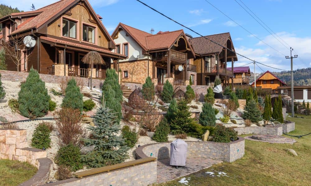
Plenty of hillside homes sit above a yard built in steps. One flat level holds a patio, the next holds a lawn and a third might hold a garden bed or a small deck. Each level rests on a retaining wall or a slope, and each sits at its own height. A residential survey gives you a measured record of those levels before you plan any changes. It shows where each terrace sits, how tall each wall stands and how the ground steps down from the house to the lower yard. That record gives your designer, contractor and engineer the same starting point.
A terraced yard is harder to map than a flat lot because the ground changes height in sudden jumps instead of a smooth slope. A survey crew can’t take a few points and connect them with straight lines. The top of a wall and the ground at its base may sit a foot apart on a map, yet several feet apart in height. Miss one of those points and the drawing can show a gentle slope where a sharp drop really exists.
Access adds another layer of work. Narrow steps, thick plants and tight gaps between walls can block a clear view for survey equipment. Crews often need more setups on a terraced lot than on a flat lot of the same size. Every setup has to tie back to the same reference points so all the levels fit together on one drawing.
Age can play a part too. Some hillside terraces went in decades ago, and later owners may have added or rebuilt levels without updated drawings. Fresh field measurements show the yard as it stands today, which matters more than an old sketch.
A residential survey can map each terrace as its own area, with its shape, its height and the features on it. The exact detail depends on what you order. A basic boundary survey may not include heights at all, so tell the surveyor you want terrace detail. When you ask for it, the drawing can show:
Seeing every level on one sheet reveals things a walk through the yard won’t. A lawn that looks flat may drop several inches toward one wall. If the survey includes boundary work, it can also show how close a patio or wall sits to a side property line. Those details shape what you can build and where.
Retaining walls hold up most terraced yards, so the survey treats them as main features. A surveyor usually records each wall’s location and length along with the height at its top and base. Where a wall steps up or down along its run, extra points capture each change. The finished drawing shows how tall the wall stands at different spots, and that height rarely stays the same from end to end.
Stairs get similar care. A crew can record where each stair sits, the height of its top and bottom landings and the path it follows between levels. You’ll want that information if you plan to widen a stair, add a railing or move the entry to a lower yard.
Grade change is the surveying term for a shift in ground height. On a terraced lot, grade changes show up at wall faces, at slope edges and at the start of each stair run. The surveyor marks these spots on the drawing so the map doesn’t smooth over a real drop. A survey records what exists on the ground. It doesn’t judge whether a wall is safe or built to code, and a licensed engineer should answer that question.
Elevation data is the set of height readings that shows how high each point on your lot sits compared to a fixed reference point. On a terraced yard, that data becomes the base for most design choices. A landscape architect uses it to plan a new level. An engineer relies on it to design a wall, and a contractor uses it to estimate how much soil comes out or goes in.
Elevation data matters most when a project changes the ground. Adding a level, raising a patio or cutting deeper into the slope all depend on knowing the current heights. The data also lets a designer compare levels side by side and pick the one with the most room for a new feature.
Local rules raise the stakes in Los Angeles. The Baseline Hillside Ordinance sets limits on how much grading a project can do within the Hillside Area shown on the city planning department’s map. That planning map differs from the Hillside Grading Area the building code uses, which comes from a separate city engineering map. Designers working under those limits need accurate heights to estimate cut and fill, meaning the soil removed and the soil added. Check with the city early to learn which rules apply to your parcel.
Order the survey before design work starts, not after. The drawing gives everyone the same measurements, which cuts down on guesswork between your designer and your builder. Share the full file, including any digital CAD version, so your team can place new work right on top of the existing levels.
Check a few things when the survey arrives. Confirm that every terrace, wall and stair you care about appears on the drawing. Look at the survey date and the reference used for heights, since your design team will need both. Ask the surveyor about anything that looks off, such as a wall that seems shorter on paper than it does in person.
Retaining walls on hillsides can draw extra review. City guidance lists retaining walls and related shoring outside a building’s footprint among the items that Grading Division inspectors check, mostly in the city’s hillside areas. Requirements depend on the wall, the lot and the scope of work, so ask the city or your engineer before you commit to a plan. A current survey gives them a clear picture of what already stands in your yard.
Does a residential survey show every level of a terraced yard?
It can, as long as you request that level of detail. A standard boundary survey focuses on property lines and may leave out heights entirely. Ask for topographic information or spot heights on each level when you order, and get the scope confirmed in writing.
Can retaining walls be shown on a residential survey?
Yes. Surveyors routinely locate walls on a drawing and note how high they stand at the top and base. The survey won’t rate a wall’s condition, so bring in an engineer if a wall leans, cracks or worries you.
What survey information helps when redesigning hillside terraces?
Level heights, wall positions and the location of stairs and built features give designers the most to work with. Property lines matter as well when new work comes close to the edge of the lot. Your designer can tell you which items their plan needs before you order.