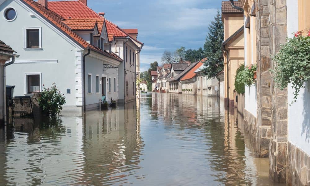
San Francisco just faced its first real storms of the season, and the impact is already clear. Heavy rain pushed stormwater into an aging sewer system, sending polluted runoff toward the Bay. Reports show the city discharged more than 9 million gallons of sewage in 2024, and four Bay Area beaches landed on California’s “dirtiest” list this fall. For homeowners, these headlines are more than environmental warnings. They’re reminders that water doesn’t always flow where you expect. That’s why now is the time to consider a flood elevation survey before the next storm causes damage.
The first heavy rains, often called the “first flush,” carry everything that has built up during dry months: oil, debris, and even sewage. In San Francisco, where storm drains and sewer lines are combined, this surge can overwhelm the system. When it does, the overflow doesn’t only affect the ocean. It can push water back toward homes, garages, and low-lying streets.
Neighborhoods like Outer Sunset, Parkside, and Lakeshore sit on flat or reclaimed land. These areas often experience water pooling after storms, even outside of mapped flood zones. If you own property here, you may not see water rushing in every year, but when it does, the costs can be brutal.
Many people think flood risks are obvious. You look at a slope, a drain, or a curb and make a judgment. But stormwater doesn’t follow hunches. It follows the lowest path, and those paths are often hidden.
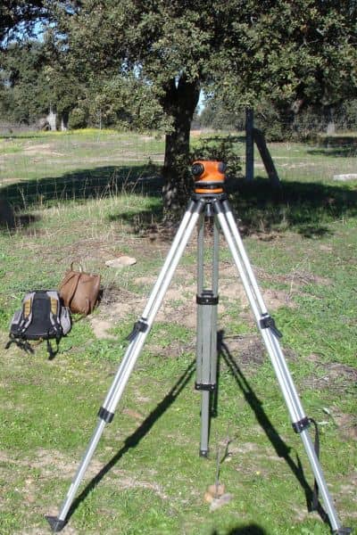
A flood elevation survey is the only way to see the full picture. In fact, local survey experts know how to capture the tiny differences in elevation that homeowners often miss. They measure more than just property lines on a map. They record garage thresholds, basement entries, yard depressions, and driveway slopes, then connect all of those points to official flood benchmarks.
In San Francisco, where inches can make the difference between a dry basement and a flooded one, this data is gold. The results often surprise property owners. What looks safe to the naked eye may in fact sit just low enough to catch the next surge of water.
You’ve probably heard of FEMA flood zones. They’re useful, but they’re broad. A FEMA map shows general areas of risk, not the details of your specific lot. Many homes outside official flood zones still flood because of local drainage or infrastructure problems.
San Francisco is a perfect example. Its sewer system is old, and its neighborhoods are dense. When the system backs up, water may spill into streets and yards that FEMA maps don’t mark as dangerous. That’s why a flood elevation survey is so valuable. It fills the gap between broad federal maps and the real risks on your property.
Water damage doesn’t just ruin floors or drywall. It seeps into foundations, causes mold, and erodes property value. Repairs can climb into six figures, and insurance doesn’t always cover the losses. In fact, premiums often rise after a claim, and some claims are denied without documented elevation data.
Imagine you’re selling a home. A smart buyer hires an inspector who asks about elevation. Without current survey data, the sale can stall, or the buyer might demand a lower price. Now imagine you’re renovating. The city may hold up your permit until you provide verified elevation information. Both situations can cost you time and money.
Spending a fraction on a survey today can save thousands, even millions, later. That’s not an exaggeration—it’s reality in flood-prone cities.
This year’s early storms were a preview. They revealed clogged drains, yards that slope toward homes, and garages that sit just below street level. In many cases, homeowners won’t notice the danger until the next storm is bigger and faster.
Surveyors call this the “first-flush warning.” The first storm shows you where the system breaks. A flood elevation survey captures those vulnerabilities in numbers and drawings. It gives you the tools to correct grading, add drainage, or update insurance before disaster hits.
Every city has flood risks, but San Francisco is unique. It mixes steep hills with flat, low-lying districts. It has neighborhoods built on reclaimed shorelines. And it has one of the oldest combined sewer systems in the country.
These factors mean that water can pool in unexpected places. A garage in the Sunset may flood even if a hillside home in Twin Peaks stays dry. Add sea level rise and stronger storms, and the risks will only grow.
That’s why local knowledge is key. A surveyor who understands infrastructure can spot red flags that outsiders might miss.
If the recent storms left you nervous, don’t wait for the next one to prove your instincts right. Book a flood elevation survey before the winter season gets worse. Use it to:
A survey isn’t about scaring yourself. It’s about preparing smartly. Once you know the numbers, you can take steps that match the risk—whether that means adjusting grading, sealing entry points, or simply updating your records.
The first storms of the season are more than just a wet inconvenience. They are nature’s stress test of San Francisco’s aging systems. And they reveal which properties are ready—and which aren’t.
A flood elevation survey gives you the clarity to act before the next storm hits harder. It turns guesswork into data, and data into savings. In a city where inches can decide the difference between a dry home and a disaster, that’s worth every penny.
Now is the time to protect your property, your investment, and your peace of mind. Don’t wait until your garage fills with water. Take the warning from San Francisco’s first storms and act before the next one arrives.


