The past few days have been filled with viral videos of massive landslides, flooded streets, and entire hillsides collapsing after a powerful typhoon hit the Philippines. Millions of people evacuated as heavy rain triggered slope failures and sudden flooding. Those clips spread fast across TikTok and Facebook because they’re shocking and hard to ignore. If you watched any of them, you probably felt that small tug of worry: “Could something like that happen here?” And here in Roseville—especially near Dry Creek, Secret Ravine, or any of our sloped neighborhoods—those videos hit closer to home than most people think. This is where an elevation survey becomes important. Understanding the height of your home compared to nearby land and water can make all the difference when the next big storm rolls in.
The landslide videos you’ve seen aren’t just random disasters. They follow the same pattern over and over:
Even though the scenes come from the Philippines or other countries, the science behind them applies everywhere. When water piles up faster than the soil can drain, slopes fail. It doesn’t matter if the slope is a mountain or a small hillside behind someone’s backyard.
Atmospheric rivers hit Northern California each winter, and they bring the same ingredients: nonstop rain, softened soil, and fast-moving water. Some winters feel mild, but others turn quiet neighborhoods into flood zones overnight. Because of that, many Roseville homeowners—especially those near creeks—are taking a closer look at their property elevations.
Dry Creek and its branches wind through many neighborhoods. These waterways are peaceful most of the year, but heavy storms turn them into fast-moving channels. Water rises quickly. Soil loosens. Backyards close to the creek fill with rushing water.
The City of Roseville tracks flood behavior constantly. It also updates FEMA flood maps and encourages homeowners to check whether their risk has changed. Some homes get added to higher-risk zones after big storms, while others get downgraded.
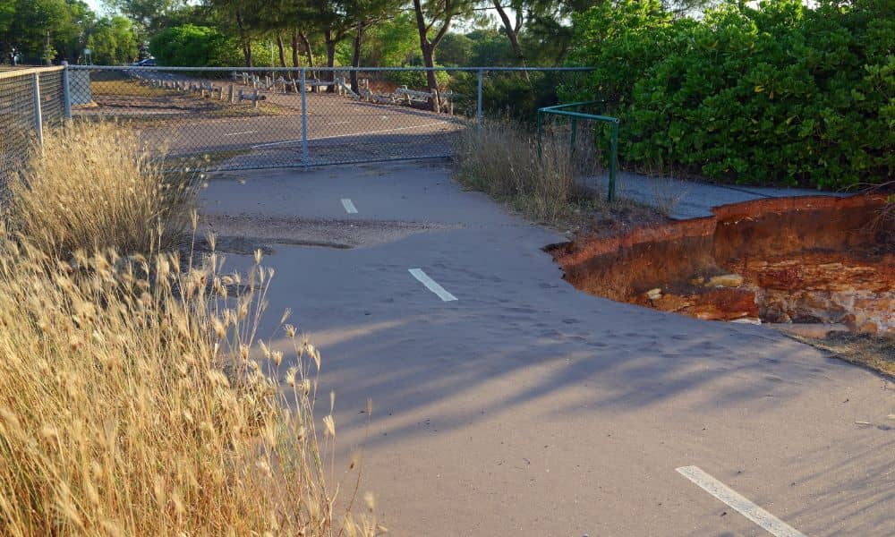
Even outside official floodplains, everyday signs reveal how water really moves:
These may seem small, but they follow the same pattern as the viral landslides—just on a smaller scale. Water goes where gravity pulls it, and if the ground can’t hold it, problems begin.
That’s why understanding your property’s true elevation is so important.

An elevation survey shows the height of your home and your yard compared to nearby land, streets, and waterways. It answers simple but critical questions:
It’s not just for flood zones. Even a gentle slope can send water across your lot in ways you wouldn’t expect.
The results help you make better decisions before a storm ever hits.
You don’t need to live right on Dry Creek to benefit from one. Many parts of Roseville have rolling terrain and mixed elevations, which change how water behaves during a storm. Here are situations where an elevation survey makes sense:
These areas react fastest to heavy rain. Even if you’ve never flooded before, your elevation relative to the creek matters.
Backyards built on slopes can shift over time, especially after wet winters. A survey shows how vulnerable the slope is.
Pooling water today becomes a real problem during the next major storm.
Older neighborhoods sometimes have grading that no longer matches original plans. A survey gives clarity before you commit.
The city often needs elevation information to approve designs, especially when backyard slopes are involved.
An elevation survey can confirm your true risk—and sometimes even lower flood insurance costs.
Most people forget about drainage until they see landslides on social media. But the truth is simple: storms don’t care if you ignore them. Water always moves downhill, and if your house sits in its path, the damage can be expensive.
Climate patterns have become more unpredictable. Roseville gets hit by powerful rain systems more often now than a decade ago. When soil becomes saturated, small issues turn into big ones. A yard that handled water fine in past years may not hold up next time.
An elevation survey gives you real, measurable information—so you aren’t guessing.
A homeowner notices water rising close to their fence during heavy storms. An elevation survey shows the yard sits only a few feet above the creek. They install proper drainage before water reaches the foundation.
A new ADU is planned, but the slope pushes water toward the house. A survey reveals the low points and helps the designer adjust the building pad.
Water pools after every storm because grading has changed over the years. A survey shows which areas need re-sloping or drains.
These aren’t rare situations. They happen every winter.
A surveyor looks at:
Sometimes, homeowners also request a topographic survey or drone mapping to get a full view of the lot. For steep or complex yards, these tools create highly accurate 3D models that show how water could move during extreme rain.
If your home sits near Dry Creek, Secret Ravine, or any sloped area, the answer is simple: yes, it’s worth it. After watching viral landslide footage, it’s normal to start wondering about your own home’s safety. But instead of guessing, elevation surveys give you real answers. They show how your property handles water, how high your home sits, and whether you’re at risk before the next atmospheric river hits.
In short, they’re one of the smartest ways to protect your investment, your peace of mind, and your home’s long-term safety.


