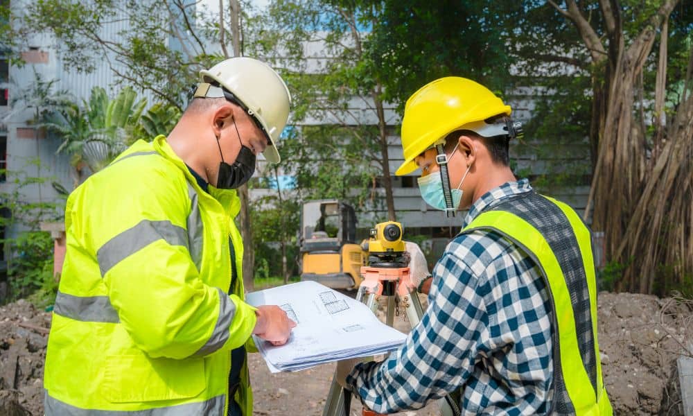
Buying land for development can feel exciting. A property may look open, flat, and ready for building. However, land often has hidden conditions that you cannot see during a quick visit. One common surprise involves easements. These legal rights allow other parties to use part of the land for a certain purpose. Because of this, many developers bring in a surveyor early and request a land survey before development begins. In many cases, that survey is completed as part of a due diligence survey. It helps reveal details that may not appear in listings, maps, or basic property descriptions. Most importantly, it can uncover easements that may limit how the land can be used.
Without that information, a project may face problems later.
An easement gives another party the right to use part of a property while the owner still keeps the land. Many people do not realize how common these agreements are. Cities, utility companies, and nearby properties often rely on easements to keep services running and access open.
For example, underground power lines may run across a section of the land. In other cases, stormwater drains may pass through part of the property. Some parcels also include access easements that allow a nearby lot to reach a road.
Although these rights help communities function, they can affect development plans. A building cannot sit on top of certain easements. Some areas must stay clear so crews can reach pipes, wires, or other equipment.
Because of this, it is important to find easements early. A due diligence survey helps reveal these conditions before designers begin planning buildings or site layouts.
Many buyers believe the land they see tells the whole story. If the property looks empty, they assume they can use the entire parcel. However, that assumption can cause problems later.
Easements often appear only in legal records filed many years ago. Some were created when the land was first divided into lots. Others were added when utility lines were installed.
Because of this, there may be no signs on the ground showing where the easement sits. A developer might see open space while a legal restriction still applies to that same area.
For example, a design team might place a building where a utility corridor actually exists. When city officials review the plans, they find the conflict. At that point, the project must change.
These situations can delay construction and raise costs. That is why developers often rely on a survey during the due diligence process to uncover hidden conditions before design work begins.
Surveyors use research and fieldwork to understand how easements affect a piece of land. First, they review property records. Title documents, subdivision maps, and legal descriptions often mention easements tied to the parcel.
Next, surveyors visit the site to collect measurements and observe existing features. They look for clues that may show where utilities or access paths exist. Utility boxes, poles, drains, and worn paths sometimes point to an easement.
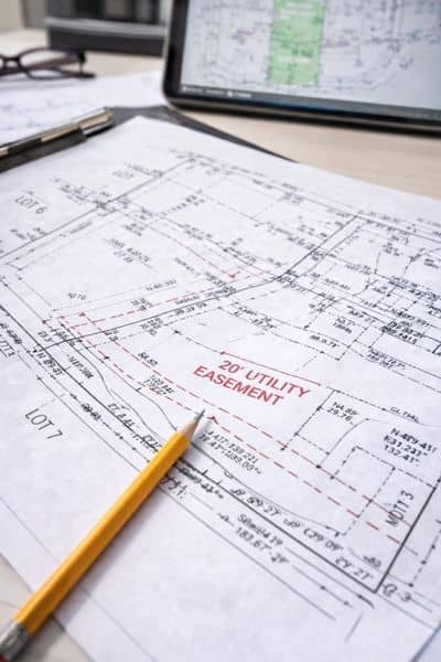
After gathering this information, surveyors map the property boundaries. Then they place all known easements onto the survey drawing. This map shows where the easements sit in relation to the rest of the land.
With that information, developers can clearly see the real limits of the property before building begins.
When easements go unnoticed, development plans can run into problems during approval. A project may look perfect on paper until someone discovers that part of the design sits within a restricted area.
For example, a building may overlap a utility easement that must stay open. In other cases, a parking lot may block an access path used by a nearby property. Drainage easements can also stop grading or landscaping in certain areas.
These problems often require changes to the design. Architects and engineers may need to move structures or adjust the layout. Sometimes the approval process pauses until the design team fixes the issue.
Because of this risk, developers prefer to learn about these restrictions early. A due diligence survey allows them to spot possible conflicts before spending time and money on detailed plans.
Successful projects depend on clear information from the start. Developers want to know exactly what they can build and where buildings can go.
A due diligence survey gives them that clarity. When easements appear clearly on the survey map, architects and engineers can design around them from the beginning. This approach reduces the chance of redesigns or delays later.
Early survey work also helps buyers decide if a property fits their goals. A parcel may look large enough for a project. However, easements may reduce the usable space more than expected.
With reliable survey data, developers can make smarter choices about site planning and project design.
Every construction project depends on good information about the land. When that information is missing, design teams may face problems during permits or construction.
A due diligence survey helps prevent these problems by revealing the legal and physical conditions tied to the property. Surveyors confirm boundaries, locate easements, and map features that affect development.
This clear picture allows developers, engineers, and planners to move forward with confidence. Instead of reacting to surprises, the team can plan around known conditions.
Hidden easements can affect even the best development site. They may limit where buildings can go, where roads can run, or where utilities must stay open. Yet many of these restrictions remain hidden in property records until someone investigates the land.
That is why a due diligence survey plays an important role before development begins. It reveals the legal rights tied to the property and shows how those rights affect the land.
With this information, developers can plan projects that respect property limits and avoid costly problems. Clear information leads to better planning, stronger designs, and smoother development from the very beginning.


