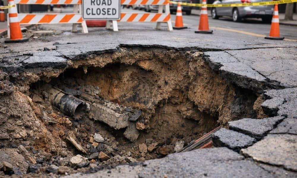
A road looks solid—until it isn’t. Recently, a dramatic sinkhole swallowed part of a street and damaged vehicles after underground infrastructure failed. Videos spread fast. People felt shocked. However, engineers know these events rarely happen without warning. In most cases, problems build underground long before the surface cracks. If you plan to build, this matters more than you think. Beneath sidewalks, streets, and backyards sit layers of pipes, old trenches, utility crossings, and fill soil from decades past. Because of that, any excavation can disturb more than just dirt. That’s where a construction survey becomes critical. It gives you clear data before you break ground—so the ground doesn’t break under you.
Oakland has character. It also has age. Many neighborhoods contain underground water lines and sewer systems installed generations ago. Over time, small leaks wash soil away. Old trenches settle unevenly. Utility maps fail to match reality. As a result, voids can form quietly below the surface.
At first, nothing looks wrong. Pavement holds. The soil feels firm. Yet water pressure or vibration from equipment can trigger a sudden collapse. In dense areas, one failed pipe can affect a whole stretch of roadway.
In addition, Oakland’s hillside terrain adds more complexity. Slopes create drainage pressure. Seismic activity shifts soil slowly over time. When you combine age, slope, and underground congestion, you get a higher risk environment for excavation.
Many property owners assume that collapse comes from “bad soil.” Sometimes that’s true. However, excavation often acts as the trigger.
When crews dig for footings, trenches, or retaining walls, they remove soil that supports nearby ground. That changes pressure balance. Heavy equipment adds vibration. Meanwhile, water lines or storm drains nearby may already sit under stress.
Even a small project—like tying into a sewer lateral—can disturb fragile soil conditions. If voids exist, digging exposes them. If soil has washed away under pavement, removing nearby support may cause the surface to drop.
Therefore, before any shovel hits the ground, you need verified site data. You need to know what exists, where it sits, and how it relates to your project design. A construction survey provides that clarity.
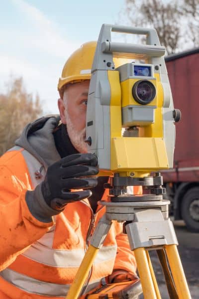
Many people think a construction survey only marks corners. That idea misses the bigger picture. In reality, a construction survey creates a verified framework for your entire project.
First, surveyors establish accurate site control. They tie your project to known coordinate systems. That ensures your plans match real-world conditions.
Next, they confirm elevations and surface grades. Elevation relationships matter. Water flows based on grade. Underground systems rely on precise slope. Even a small difference can create drainage problems.
Then, surveyors verify the position of existing improvements. They confirm where curbs, sidewalks, utility vaults, and property lines sit in relation to proposed excavation.
Most importantly, a construction survey documents existing site conditions before work begins. That documentation protects you if disputes arise later.
In short, it gives you facts—not guesses.
Oakland sees many infill projects. Owners build additions. Developers replace small structures with larger ones. Contractors work close to neighboring foundations.
Because these sites sit tight, risk increases. You may dig within feet of a public sidewalk or shared retaining wall. You may trench near water or gas lines that serve multiple homes.
In these cases, mistakes cost more than money. They affect neighbors. They trigger city inspections. They can stop work immediately.
However, when you start with a construction survey, you reduce that risk. You understand where improvements sit. You confirm setback distances. You align excavation zones with verified data.
That preparation creates confidence before equipment arrives.
Infrastructure failure brings more than repairs. It brings responsibility.
If excavation damages a water main, who pays? If soil collapse cracks a neighbor’s driveway, who handles the claim? If a sidewalk fails after trenching nearby, who answers the city?
Without documentation, liability becomes unclear. Insurance companies ask for proof of pre-construction conditions. City agencies request measurements. Neighbors demand answers.
A construction survey creates a record. It shows site control. It documents elevations. It confirms boundaries and easements. Therefore, if issues arise, you can show what existed before work began.
That record does not eliminate risk. However, it reduces uncertainty. In dense urban areas, that difference matters.
Flat land behaves differently from hillside terrain. Oakland contains both. In hillside neighborhoods, retaining walls support roads and homes. Drainage systems manage runoff during heavy storms. Soil stability depends on balance.
When excavation changes the grade near a slope, water flow can shift. If runoff redirects, erosion may follow. If retaining structures lose support, movement can occur.
Moreover, older infrastructure often runs beneath these areas. Over decades, repairs and patches create layers of buried systems. As a result, underground conditions rarely match original drawings.
A construction survey verifies what you can see. It confirms surface relationships. It ties everything to precise coordinates. That data supports engineers and contractors as they plan excavation safely.
Some owners assume collapse risk only applies to large developments. That belief causes trouble.
Consider a homeowner building an accessory dwelling unit. Excavation for new footings may sit near a property line. Utility lines may cross diagonally through the yard. Soil may have settled from past trenching.
Without accurate measurements, you may dig too close to an easement. You may cut into a utility corridor. You may undermine nearby improvements.
However, when you order a construction survey before excavation, you start informed. You know where boundaries sit. You know where setbacks apply. You understand how grades interact with surrounding structures.
That knowledge prevents avoidable problems.
Emergency repairs move fast and cost more. Crews respond under pressure. Roads close. Equipment rushes in. Public frustration grows.
On the other hand, preparation moves calmly. Surveyors measure. Engineers review. Contractors plan excavation zones with confidence.
A construction survey does not guarantee that the ground will never shift. Still, it gives you the best possible information before you change site conditions.
In Oakland’s mixed terrain and aging infrastructure environment, that preparation makes practical sense.
Infrastructure failures make headlines because they shock us. Yet underground systems change slowly over time. Soil erodes quietly. Pipes leak gradually. Voids form out of sight.
Construction disturbs that balance. Therefore, responsible projects start with verified data.
If your project involves excavation—whether for a new build, an addition, or utility work—consider a construction survey part of your foundation. It protects your investment. It supports your contractor. It strengthens your position if questions arise.
Most importantly, it helps ensure the ground stays where it belongs—under your project, not inside it.


