In San Jose, we trust technology. We use apps to order food, track packages, and even unlock our front doors. So it feels natural to trust online maps when checking property lines. After all, if a map shows a boundary, it must be right… right? Unfortunately, that assumption causes real problems. More and more homeowners rely on online parcel maps instead of hiring a land surveyor. As a result, neighbors argue, fences move, and legal bills rise. What looks like a simple line on a screen can turn into a major property dispute.
When you open a county parcel viewer or check Google Maps, you see clear lines. Those lines seem precise. However, they only show approximate data.
Most online maps pull information from tax records and old subdivision drawings. They scale those records to fit a digital display. That process works for general reference. It does not work for legal decisions.
In fact, many county websites include a disclaimer. They often state, “Not for legal determination.” Still, most people never read that fine print.
So, while the map looks official, it does not confirm your true property line. Only a licensed land surveyor can do that.
San Jose homes sit close together. Many lots measure small. Property values also run high. Because of that, every foot matters.
At the same time, homeowners improve their properties more than ever. People install new fences, build backyard patios, or upgrade landscaping. Others add solar panels or expand driveways. Each project brings improvements closer to boundary lines.
Now add one more factor: tech confidence.
Living in Silicon Valley, many homeowners trust digital data. They assume online tools offer high precision. As a result, they skip the step of hiring a land surveyor. That decision often leads to trouble.
Imagine this.
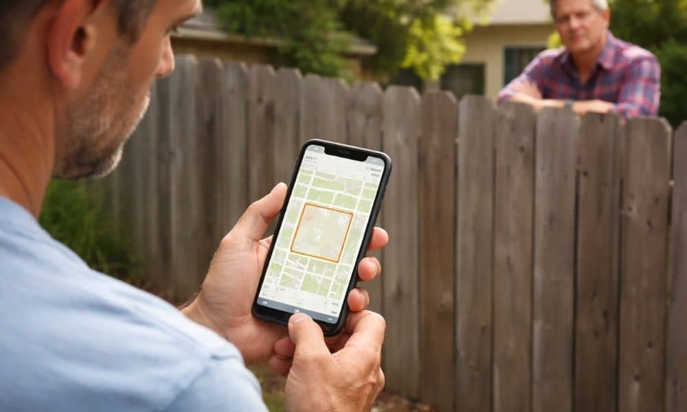
A homeowner checks an online parcel map. The line appears clear. So they install a new fence right along that line.
A few weeks later, the neighbor complains. They believe the fence crosses into their yard. Tension builds. Eventually, one neighbor hires a land surveyor.
The survey shows the fence sits two feet over the legal boundary.
Now what?
The fence must move. The homeowner pays removal costs. Meanwhile, trust between neighbors disappears. What started as a simple improvement turns into stress and expense.
Unfortunately, this scenario happens often.
You may wonder how digital maps miss by so much.
First, many properties in San Jose date back decades. Original subdivision markers may shift over time. Construction, landscaping, and soil movement can disturb old boundary monuments.
Second, digital maps rely on scaled drawings. They do not reflect current field measurements. Even a small scaling error can shift a boundary line by several feet.
Finally, fences and hedges rarely sit on true property lines. Builders sometimes placed them based on guesswork or old assumptions. Over time, those assumptions become “accepted” lines — even when they differ from the legal boundary.
Only a land surveyor verifies the correct line using physical evidence on the ground.
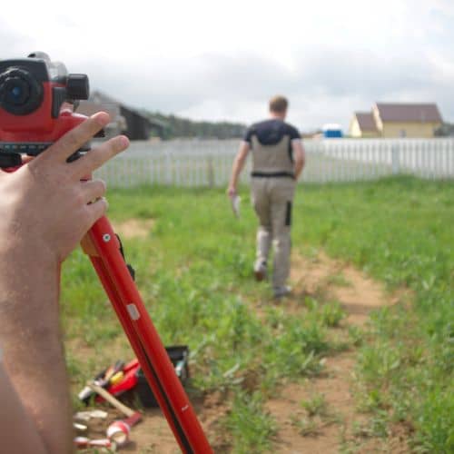
Many homeowners picture someone simply measuring with a tripod. In reality, a land surveyor does much more.
First, the surveyor reviews historical records. That includes deeds, subdivision maps, and prior surveys. Those documents contain the legal description of the property.
Next, the surveyor visits the site. They search for boundary monuments, such as iron pipes or brass caps placed decades ago. These markers serve as physical proof of property corners.
Then, the surveyor measures distances and angles between those markers. They compare field data to historical records. If conflicts appear, they analyze which evidence holds legal priority.
Finally, the surveyor prepares a formal drawing that shows the true boundary. That document carries legal weight. Courts and title companies accept it as reliable evidence.
Online maps cannot perform any of those steps.
Some homeowners avoid hiring a land surveyor to save money. However, guessing often costs more.
Fence relocation alone can cost thousands of dollars. In addition, legal consultations add more expense. Meanwhile, neighbor disputes create tension that lasts for years.
Property sales also suffer. During resale, buyers may request proof of boundaries. If disputes exist, closing can stall. That delay affects both time and value.
So, while online maps cost nothing, mistakes rarely stay cheap.
In San Jose, land carries high value. Every square foot matters. Therefore, boundary issues feel serious.
Additionally, homeowners often treat their yards as extensions of their living space. When someone challenges that space, emotions rise quickly.
Social media also spreads misinformation. People share screenshots of parcel maps as proof. Others assume that if a line appears online, it must be correct. Unfortunately, that belief fuels more disagreements.
A land surveyor brings clarity. Instead of opinions, they provide measured facts.
Not every situation requires a survey. However, certain moments demand clarity.
Call a land surveyor if:
Taking this step early prevents stress later.
San Jose leads the world in technology. We rely on data every day. However, property boundaries do not live in the cloud. They exist in physical space, backed by legal records.
Online maps serve as helpful references. Yet they do not replace professional verification.
Before you trust a digital line, consider the real cost of being wrong. A qualified land surveyor provides certainty, protects your investment, and helps you avoid disputes that can last for years.
In a city built on precision, your property boundaries deserve the same level of accuracy.


