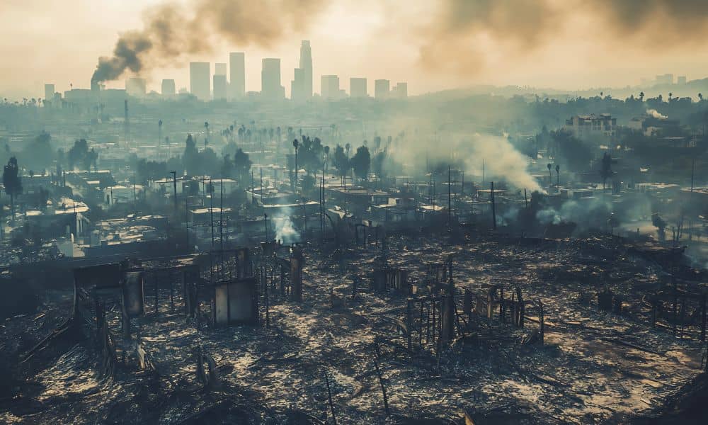
Los Angeles has always faced wildfire seasons, but 2025 changed the landscape in a way many residents didn’t expect. Hillsides shifted, drainage paths moved, and entire canyons looked different after the flames. As the smoke cleared, one thing became clear: the city needed better tools to understand what happened beneath the surface. That’s where lidar mapping stepped in. This technology helped officials, engineers, and local communities see the true impact of the fires and plan what comes next. And just as LA was absorbing the wildfire damage, the SoCal LiDAR Summit arrived—bringing experts together to show how the city can rebuild smarter.
The January 2025 wildfires swept through parts of the Palisades, Eaton Canyon, and nearby foothills. Even after the flames died, the danger didn’t end. Burned hills can collapse, drain differently, and send debris flowing toward homes during storms. Many neighborhoods needed a safe and quick way to understand the new risks.
Traditional field surveys take time, and walking through unstable slopes isn’t safe. LiDAR mapping made it possible to scan huge areas in days instead of weeks. Because it uses lasers from an aircraft or drone, it captures every bump, dip, and change on the ground—even through leftover ash and debris. As a result, LA finally had a clear picture of what changed.
Shortly after the fires, the USGS released high-resolution LiDAR data showing the full extent of the terrain changes. For many people, this was the first time they saw how deeply fire can reshape the ground.
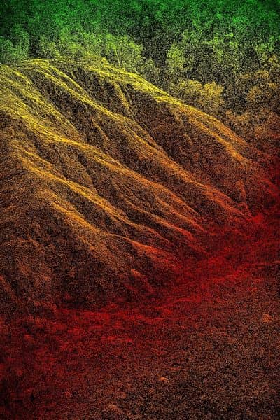
Burn scars run deeper than they look. From above, a burned area might look flat or harmless. LiDAR proved the opposite. The scans showed loose soil where roots burned away, new channels carved by flash erosion, and steep slopes that could collapse after a heavy rain. These details helped communities understand which areas were still at risk long after the flames were out.
Debris flow paths also shifted overnight. Wildfires often remove plants that hold soil in place. When the next storm hits, mud and rock can travel far from the burn zone. LiDAR mapping revealed the fresh paths debris could take. This allowed emergency teams to plan ahead, warn homeowners, and prioritize clearing work.
Some canyon roads looked fine from a car window, but LiDAR scans showed slight drops and cracks that could turn into real hazards. With this information, engineers could fix weak areas early instead of waiting for them to fail.
LiDAR didn’t only show where things went wrong—it also helped people plan how to repair and protect the hillside communities.
It helped spot danger before rain arrived. LA’s rainy season can trigger landslides after a wildfire. Because LiDAR maps captured accurate elevation data, teams could make models showing where slopes might slide. This made it easier to place barriers, reroute water, and guide residents on how to stay safe.
It also helped homeowners and HOAs understand their risk. Many residents didn’t know if their homes were at risk. LiDAR gave a picture they could trust. Neighborhood boards used the maps to work with engineers, check problem areas, and apply for assistance or insurance support.
Retaining walls and hillside foundations faced new pressure after the fires. Even small ground shifts can lead to major damage. LiDAR helped structural engineers see exactly how the slope changed so they could design better repairs.
Finally, it improved emergency response routes. Firefighters, public safety teams, and road crews all needed updated information. LiDAR maps showed blocked paths, unstable slopes near roads, and areas where fallen debris could trap vehicles. This helped them create safer routes and faster evacuation plans.
Just as LA was working through the post-fire data, the SoCal LiDAR Summit 2025 took place at Fullerton College. The timing couldn’t have been better. The summit brought together LiDAR experts, drone manufacturers, GIS specialists, emergency managers, and even film studios. The message was clear: Southern California is becoming a center for LiDAR innovation.
The summit mattered especially this year because it focused heavily on disaster response and community safety. Speakers showed how new drone sensors can scan steep terrain, narrow canyons, and burned slopes even faster than before. They also shared tools that help cities blend LiDAR with weather models to predict dangerous areas during storms.
Planners from LA County and nearby cities attended in large numbers. Many wanted to understand how to use LiDAR for public safety, not just engineering or construction. The wildfire damage made the need feel urgent.
Attendees learned about improved drone LiDAR systems with higher accuracy, faster software that turns millions of points into clear maps, new workflows for post-disaster scanning, and techniques for spotting slope changes before they become landslides. Because the summit was local, many teams could join the sessions, share problems, and learn directly from specialists.
The combination of wildfire damage and new LiDAR tools marks a turning point for the city.
LA will use LiDAR before and after more natural events. The city now sees LiDAR as a way to stay ahead of hazards. Instead of reacting after damage happens, agencies can scan high-risk hillsides every year to check for early signs of movement.
Insurance and HOA planning will also become more data-driven. LiDAR maps help communities make informed decisions. They show risk clearly, which helps people understand why repairs are needed and how to plan budgets.
More local experts will train in LiDAR technology. Colleges, city departments, and industry partners are adopting LiDAR training programs. Because LA has so many hillsides, canyons, and wildfire zones, the demand for skilled LiDAR technicians is rising.
A more accurate digital twin of Los Angeles is also emerging. A digital twin is a 3D model of a real place. With fresh LiDAR data, Los Angeles is building a clearer digital version of itself. This helps leaders plan safer roads, prepare for storms, and protect hillside neighborhoods.
The 2025 wildfires hit Los Angeles hard, but they also pushed the city to adopt smarter tools. LiDAR mapping gave residents, engineers, and public safety teams a clear view of the damage and the risks hidden beneath the surface. And the SoCal LiDAR Summit showed that Southern California is ready to lead the way in using this technology for safety, recovery, and long-term resilience.
If you’re trying to understand your property’s post-fire risk or simply want a clearer look at how the ground has changed around your home, exploring lidar mapping Los Angeles can make a big difference. It gives you reliable information you can use to plan repairs, protect your property, and make confident decisions moving forward.


