San Diego is home to some of the most unique and fragile natural areas in California. From wetlands and nature reserves to habitats for protected species, these environments face serious risks from both natural events like wildfires and floods, and human activities such as construction and pollution. Keeping track of how these areas change over time is key to protecting them—and that’s where LiDAR mapping services in San Diego come in.
Instead of relying on older survey methods that can be slow and hard to use in rough terrain, more professionals now turn to drone LiDAR mapping. This technology collects detailed, high-quality data from the air, even in places that are difficult or dangerous to access on foot.
San Diego has a mix of city neighborhoods, parks, and natural lands all close together. This makes planning and protecting the environment more complicated. With LiDAR mapping, drones fly over the land and collect data using lasers that measure the shape and height of the ground and other features like trees or buildings.
This technology helps track:
This kind of information is really useful for environmental groups, city planners, and even schools doing science projects on local ecosystems.
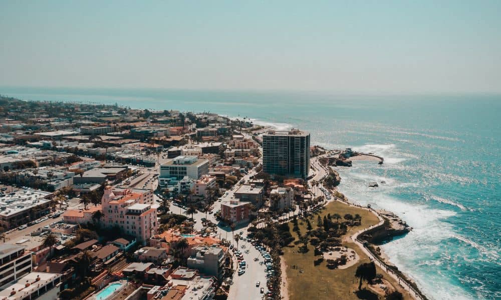
San Diego’s coastline is beautiful, but it’s also always changing. The cliffs and beaches are slowly shaped by wind, water, and rising sea levels. In some places, these changes can happen quickly and put homes, trails, or roads at risk.
Using LiDAR mapping, experts can watch these changes closely and safely. Drones can scan large areas of the coast without people having to hike or climb dangerous spots. This data helps city leaders decide where to reinforce paths, build safety fences, or plan future projects.
Forests, wetlands, and parks across San Diego are home to many different plants and animals. But fire, drought, and construction can threaten these ecosystems. LiDAR mapping helps show how thick the tree canopy is, how healthy plants are, and where animal habitats are shrinking or moving.
In protected areas like Mission Trails or Torrey Pines, this data helps conservation groups track the impact of weather or human activity over time and take action before serious damage occurs.
San Diego, like many cities, is dealing with problems caused by climate change—like more heatwaves, floods, and wildfires. With LiDAR mapping, city planners can:
This helps the city make smart decisions about planting more trees, improving drains, and keeping people safe in emergencies.
The best thing about LiDAR mapping is that it can be used with other tools. Scientists can combine LiDAR data with satellite images, weather reports, and old maps to study changes over months or even years.
This layered approach gives a complete picture of what’s happening in San Diego’s environment. It helps people make better choices about how to protect land, use resources, and prepare for the future.
A lot of San Diego’s environmental work depends on teamwork. Government agencies, nonprofit groups, and even private landowners all have a part to play. When they all have access to the same reliable data, it’s easier to work together.
That’s one reason why drone LiDAR mapping in San Diego is so valuable. It provides a clear, shared view of the land that everyone can use when planning, discussing, or solving problems related to the environment.
LiDAR mapping is helping San Diego protect its natural spaces, plan smarter cities, and face environmental challenges head-on. By using drone technology to gather accurate and detailed information, we can better understand our land and make decisions that benefit people and nature alike.
Whether you’re restoring a wetland, preparing for a flood, or studying trees in your local park, drone LiDAR mapping gives you the tools to do it better, faster, and more safely.


